Deforestation · 2001–2025
Deforestation in Saint Lucia
Since 2001, Saint Lucia has lost about 1,110 hectares of forest (about 1,600 football pitches): 2.2% of the forest it had in 2000. Most of it (78%) was deforestation, forest cleared for good, mainly for farms, pasture and plantations.
- Forest in 2000
- 49,700 ha
- Forest lost since 2001
- 1,110 ha2.2% of it, about 1,600 football pitches
- Cleared for good
- 869 hadeforestation, 78% of the loss
- Worst year
- 2016107 ha lost
Map
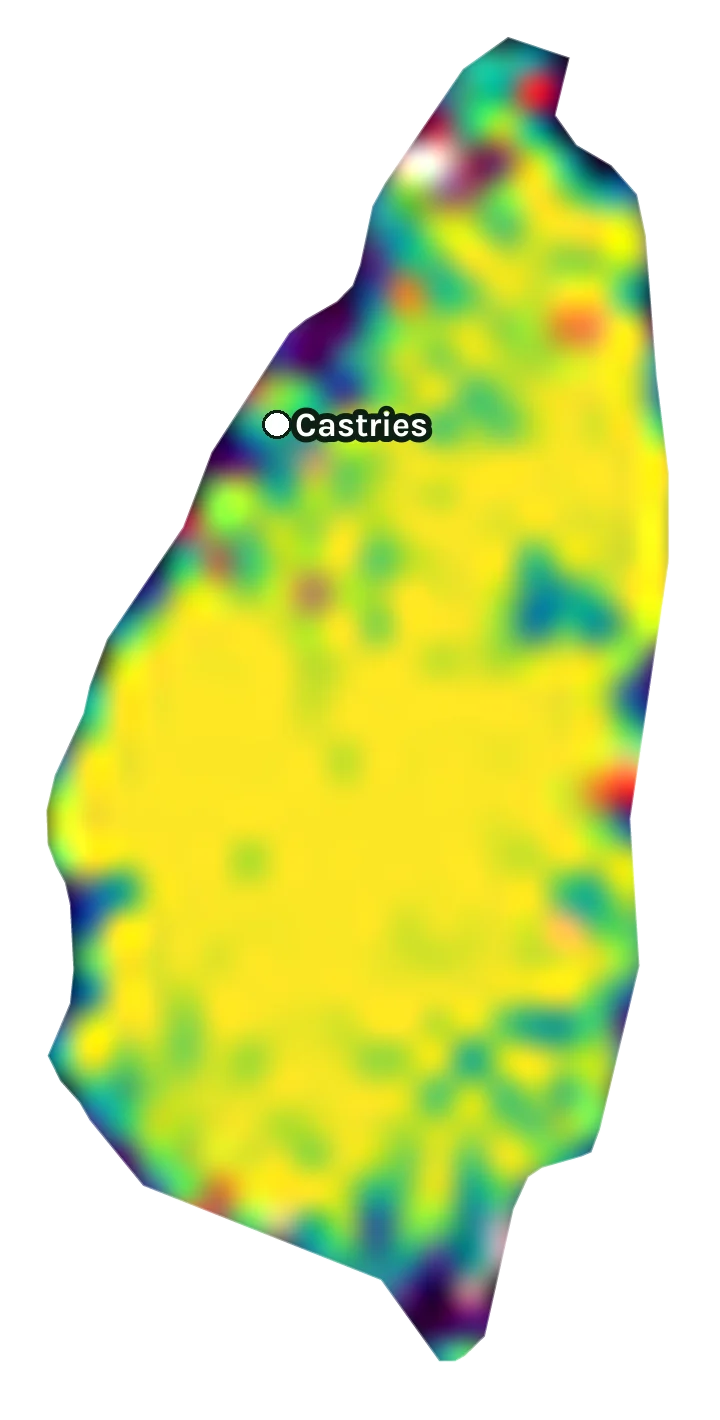
Where Saint Lucia has lost forest
Every square kilometre of Saint Lucia as satellites saw it from 2000 to 2025. Yellow and green were forest; red to white marks where it has been lost since 2001, and when.
- Forest cover in 2000
- 0%25%50%75%100%How much of the land was forest: dark purple had little or none, yellow was dense forest.
- Year the forest was lost
- 200120132025Where forest was cut down, burned or cleared since 2001: red for the early years, through orange, to white for the most recent. Solid where a fifth or more of a place's forest went, fainter where 8% or more did.
- Cities
- The capital (the larger dot) and the biggest cities, to help you find your way.
Year by year
Forest lost in Saint Lucia, year by year
Forest loss is slowing down: about 27 hectares a year in 2021–2025, down from 57 hectares a year in 2016–2020. The worst year was 2016, when about 107 hectares of forest were lost.
Hectares of forest lost each year
Show the figures as a table
| Year | Cleared for good | Can grow back | Total |
|---|---|---|---|
| 2001 | 28 ha | 2 ha | 30 ha |
| 2002 | 7 ha | 4 ha | 11 ha |
| 2003 | 16 ha | 3 ha | 19 ha |
| 2004 | 32 ha | 8 ha | 40 ha |
| 2005 | 42 ha | 5 ha | 48 ha |
| 2006 | 84 ha | 3 ha | 88 ha |
| 2007 | 32 ha | 9 ha | 41 ha |
| 2008 | 50 ha | 6 ha | 56 ha |
| 2009 | 41 ha | 12 ha | 53 ha |
| 2010 | 81 ha | 13 ha | 94 ha |
| 2011 | 35 ha | 27 ha | 61 ha |
| 2012 | 54 ha | 13 ha | 66 ha |
| 2013 | 30 ha | 6 ha | 35 ha |
| 2014 | 36 ha | 5 ha | 41 ha |
| 2015 | 7 ha | under 1 ha | 7 ha |
| 2016 | 47 ha | 60 ha | 107 ha |
| 2017 | 54 ha | 30 ha | 84 ha |
| 2018 | 14 ha | 20 ha | 34 ha |
| 2019 | 19 ha | 3 ha | 22 ha |
| 2020 | 35 ha | 5 ha | 40 ha |
| 2021 | 27 ha | 6 ha | 33 ha |
| 2022 | 29 ha | 4 ha | 33 ha |
| 2023 | 21 ha | under 1 ha | 21 ha |
| 2024 | 18 ha | 1 ha | 19 ha |
| 2025 | 31 ha | under 1 ha | 31 ha |
The satellite method improved in 2011, so compare recent years with each other rather than with the 2000s. Hover over or tap a year for its figures.
Causes
What is causing deforestation in Saint Lucia?
- 78%cleared for good (deforestation)
- 19%can grow back (fire, logging, storms)
- 3.4%cause unknown
- Farms, pasture and plantations47% · 527 ha
Cleared for good. Forest cleared for crops, cattle pasture or tree plantations: the biggest cause of deforestation in the world.
- Towns and roads31% · 341 ha
Cleared for good. Forest replaced by houses, buildings and roads.
- Storms, floods and other natural causes18% · 201 ha
Can grow back. Trees killed by storms, floods, landslides, pests or disease.
- Unknown causes3.3% · 37 ha
Cause unknown. The satellites saw the trees go, but not why.
Also, each under 1%: shifting farming.
Causes for 2025 are estimates, based on what caused forest loss in the same places up to 2024.
Is all forest loss deforestation?
No. When forest is cleared for farms, mines or towns, it is gone for good: that is deforestation. When it is logged or burned, it usually grows back. We count both as forest lost, but only the first as deforestation, so a country with a bad fire year isn't shown as clearing its forest for good.
Cities that lost the most forest around them
Forest lost within 10 km of each city centre since 2001.
| City | Forest lost | Share of its forest | Cleared for good |
|---|---|---|---|
| Castries | 382 ha | 2.8% | 318 ha |
Satellite timelapses of cities in Saint Lucia
A satellite photo a year since 2017, with the forest lost marked on it, and the figures for each city.
Frequently asked
Questions about deforestation in Saint Lucia
How much forest has Saint Lucia lost since 2001?
Since 2001, Saint Lucia has lost about 1,110 hectares of forest (about 1,600 football pitches): 2.2% of the forest it had in 2000. Most of it (78%) was deforestation, forest cleared for good, mainly for farms, pasture and plantations.
Is deforestation in Saint Lucia getting worse?
Forest loss is slowing down: about 27 hectares a year in 2021–2025, down from 57 hectares a year in 2016–2020. These are five-year averages from 2011 on, the years the satellite maps were all made the same way.
What is causing deforestation in Saint Lucia?
The main causes of forest loss since 2001 are farms, pasture and plantations (47%), towns and roads (31%), storms, floods and other natural causes (18%). About 869 hectares was deforestation, meaning forest cleared for good for farms, mines or towns. Causes for 2025 are estimates, based on what caused forest loss in the same places up to 2024.
What was the worst year for forest loss in Saint Lucia?
The worst year was 2016, when about 107 hectares of forest were lost.
How is forest loss measured?
We use satellite maps from the University of Maryland (Hansen and colleagues) that show, for every 30 × 30 m patch of land on Earth, the year its trees were cut down, burned or died, from 2001 to 2025. We add up those patches in Saint Lucia, counting only places that were at least 30% covered by trees in 2000. The cause of each loss comes from a map made by the World Resources Institute and Google DeepMind. All figures are estimates.