City report · Punjab, Pakistan
Kot Addu Air quality today
Air quality in Kot Addu currently reads AQI 457 (Hazardous): Emergency conditions — avoid outdoor activity.
Air quality right now
AQI 457
Hazardous
- PM2.5, fine particles (µg/m³)
- 303.4
- tree cover
- 17.7%
- trees in this area
- 55.6K
- more trees needed
- 85.7K
Measured across a 2 km radius around Kot Addu, Pakistan (12.57 km²), from a satellite image of Sep 14, 2026. Lower AQI is better: 0–50 is Good, above 300 is Hazardous.
Kot Addu · AQI 457 (Hazardous)
Kot Addu's tree count comes to 55,551 trees across 12.56 km² of land, 27 points below the 45% tree-cover level considered healthy for this area, so roughly 85,680 more trees would close the gap.
Air quality detail
Air quality in Kot Addu today: AQI 457, Hazardous
Main pollutant: PM2.5 · Observed Nov 11, 15:00 local time via Open-Meteo / CAMS, corrected with 4 ground-station cities within 85 km, US EPA index. Values in µg/m³.
Estimate · model corrected with 4 station cities within 85 km, e.g. Muzaffargarh and Dera Ghazi Khan
Health signal
Emergency conditions — avoid outdoor activity.
PM2.5
303.4
PM10
148.5
NO₂
10.6
O₃
141.0
SO₂
19.9
CO
546.0
- Outdoor exercise
- Everyone should avoid all outdoor exertion
- Windows
- Keep them closed and seal gaps
- Mask
- Wear an N95 if you must go out
- Air purifier
- Run one on high
Over the last 7 days, the CAMS air-quality model put Kot Addu's daily AQI at 191 on average, from 133 on Nov 6 to an hourly peak of 292 on Nov 10.
Where Kot Addu stands: the most polluted cities in the world right now · the cleanest
Tree cover detail
Tree cover in Kot Addu: Critically low
17.7% tree cover against a 45% healthy-neighborhood target, across 12.56 km² of land.
Trees in this area
55,551
Target trees
141,231
More trees needed
85,680
CO₂ if planted / yr
1,885 t
Deforestation · 2001–2025
How much forest has Kot Addu lost?
There was almost no forest around Kot Addu in 2000, so there has been almost nothing to lose since. Only fairly dense woodland counts as forest in these maps, so scattered street and garden trees don't show up here.
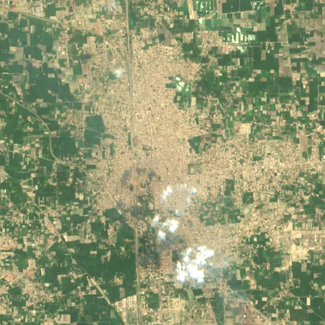
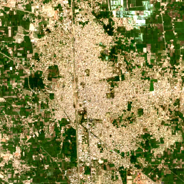

2017: satellite photo from July 2017 of a 5 × 5 km area in the city center.
Forest gained and lost, 2000–2020
- Forest in 2000
- 263 ha
- Forest in 2020
- 373 ha
- Overall change
- +110 hamore forest than in 2000
Comparing satellite maps from 2000 and 2020, the forest around Kot Addu grew from about 263 hectares to 373 hectares, a net gain of about 110 hectares (+42%). New forest grew on about 111 hectares, while under 1 hectare was lost.
These 2000 and 2020 maps, from the University of Maryland, count any land with trees taller than 5 m as forest, including plantations and orchards. Forest that was cut or burned and had grown back by 2020 counts in both years, so the loss here is smaller than the yearly figures.
These figures cover everything within 10 km of the city center, a wider area than the report above, because forest is usually lost at a city's edges.
Source: Hansen/UMD/Google/USGS/NASA, Global Forest Change (GFC-2025-v1.13); causes: WRI/Google DeepMind drivers of forest loss; both CC BY 4.0, summed by Airleaf for each area. Forest gained and lost 2000–2020: Potapov et al. 2022, UMD GLAD Global Land Cover and Land Use Change, CC BY 4.0. Images: contains modified Copernicus Sentinel data. How it's measured
In the same region
Measured cities near Kot Addu
Same 2 km radius, same index — so they compare directly.
- Taunsa40.0 km
Pakistan
- Tree cover
- 4%
- Air quality
- 564
- Muzaffargarh49.2 km
Pakistan
- Tree cover
- 16%
- Air quality
- 443
- Layyah54.8 km
Pakistan
- Tree cover
- 13%
- Air quality
- 719
- Dera Ghazi Khan56.6 km
Pakistan
- Tree cover
- 9%
- Air quality
- 659
- Multan57.7 km
Pakistan
- Tree cover
- 3%
- Air quality
- 643
- Qadirpur Ran70.4 km
Pakistan
- Tree cover
- 34%
- Air quality
- 627
Build your own
Compare Kot Addu with anywhere
This place
Kot Addu
Use this data
Put Kot Addu's numbers on your site
Free to embed. Updates itself as the measurement refreshes.

Frequently asked
Questions about Kot Addu
What is the air quality (AQI) in Kot Addu right now?
The latest reading for Kot Addu shows an AQI of 457 (Hazardous), observed Nov 11, 15:00 local time via Open-Meteo / CAMS, corrected with 4 ground-station cities within 85 km, US EPA index. The main pollutant is PM2.5. Emergency conditions — avoid outdoor activity.
Is it safe to exercise outside in Kot Addu today?
At AQI 457 (Hazardous): everyone should avoid all outdoor exertion. Windows: keep them closed and seal gaps. Masks: wear an N95 if you must go out. The reading changes through the day, so check again before a long run or ride.
What has the air quality in Kot Addu been like this week?
Over the last 7 days, the CAMS air-quality model put Kot Addu's daily AQI at 191 on average, from 133 on Nov 6 to an hourly peak of 292 on Nov 10. On 7 of those days the average was above 100, unhealthy for sensitive groups.
How much forest has the area around Kot Addu lost since 2001?
There was almost no forest around Kot Addu in 2000, so there has been almost nothing to lose since. Only fairly dense woodland counts as forest in these maps, so scattered street and garden trees don't show up here. Comparing satellite maps from 2000 and 2020, the forest around Kot Addu grew from about 263 hectares to 373 hectares, a net gain of about 110 hectares (+42%). New forest grew on about 111 hectares, while under 1 hectare was lost.
What is the tree count in Kot Addu?
Kot Addu has an estimated 55,551 trees across the 12.56 km² of land measured — 17.7% tree cover, 27 percentage points short of the 45% tree-cover target set for this area.
How many more trees does Kot Addu need?
Kot Addu needs roughly 85,680 more trees to close a 27-point shortfall against its 45% tree-cover target — about 1,885 t of extra CO₂ absorbed per year once grown.
How are Kot Addu's air quality and tree cover measured?
Air quality comes from ground monitoring stations via OpenAQ where one reports nearby, and otherwise, as here, from the Open-Meteo / CAMS model, which may differ from street-level monitors. Tree cover is measured from Sentinel-2 L2A (ESA Copernicus) via Earth Search satellite imagery at 10 m detail across a 2 km radius around Kot Addu; the tree count is an estimate derived from that cover.
See your own area
What does your neighborhood look like?
Pick any point and radius to get the same air-quality and tree-cover breakdown.
Check my address