City report · Utah, United States
Salt Lake City Air quality today
Air quality in Salt Lake City currently reads AQI 35 (Good): Air quality is satisfactory for everyone.
Air quality right now
AQI 35
Good
- PM2.5, fine particles (µg/m³)
- 6.3
- tree cover
- 14.2%
- trees in this area
- 44.6K
- more trees needed
- 49.6K
Measured across a 1.2 mi (2 km) radius around Rio Grande, Salt Lake City, UT, USA (4.9 sq mi), from a satellite image of Sep 11, 2026. Lower AQI is better: 0–50 is Good, above 300 is Hazardous.
Salt Lake City · AQI 35 (Good)
Salt Lake City's tree count comes to 44,611 trees across 4.9 sq mi (12.57 km²), 16 points below the 30% tree-cover level considered healthy for this area, so roughly 49,637 more trees would close the gap.
Air quality detail
Air quality in Salt Lake City today: AQI 35, Good
Main pollutant: PM2.5 · Observed Nov 11, 07:00 local time via OpenAQ ground stations, US EPA index. Values in µg/m³.
Ground station · Hawthorne, 2.1 mi (3.4 km) away · median of 4 stations
Health signal
Air quality is satisfactory for everyone.
PM2.5
6.3
PM10
17.0
NO₂
49.3
O₃
2.0
SO₂
2.6
CO
687.4
Data: OpenAQ · AirNow
- Outdoor exercise
- A good day to be active outside
- Windows
- Open them to air the house
- Mask
- Not needed
- Air purifier
- Not needed
Over the last 7 days, the CAMS air-quality model put Salt Lake City's daily AQI at 67 on average, from 61 on Nov 5 to an hourly peak of 88 on Nov 8.
Where Salt Lake City stands: the most polluted cities in the world right now · the cleanest
City air guide
Why does Salt Lake City get smog in winter?
Right now
- Today's AQI in Salt Lake City is 35, good, mostly from PM2.5.
- Over the past 7 days, the daily average was 67.
- November is in Salt Lake City's usual season for winter inversions (November to February), so expect bad days to come and go until it ends.
Salt Lake City's worst air comes in winter, typically from November through February, when a layer of warm air settles over the valley like a lid and traps cold air, and the pollution in it, near the ground [1]. The mountains around the Wasatch Front form a bowl that holds that cold air in place [2]. In summer the problem changes to ozone: the American Lung Association ranks the Salt Lake City area 13th worst in the US for it [3].
What is a winter inversion?
Normally the air near the ground is warmer than the air above it, so it rises and carries pollution away. During an inversion the order flips: warmer air sits on top, and cold air is trapped underneath with the exhaust and smoke released into it [1].
The valley's shape makes it worse. The Wasatch and Oquirrh mountains form a bowl around it, so the trapped cold air has nowhere to go [2]. An inversion lasts until another weather system arrives and clears the haze [1].
Where does the pollution come from?
Most of the winter smog isn't released as smoke at all. It forms in the cold air from gases: on the most polluted days in northern Utah, ammonium nitrate makes up close to 90% of the fine particles (PM2.5) [2]. Cold temperatures speed that chemistry up [2].
The gases behind it come mostly from vehicles, which produce about three-quarters of the nitrogen oxides, and from farming, which releases the ammonia [2]. Wood stoves, diesel engines and road dust add particles directly [2].
Is the air bad in summer too?
Yes, but it's a different problem. On hot, sunny days, sunlight turns gases from tailpipes and smokestacks into ozone [3]. Salt Lake County averaged 20.8 days a year of unhealthy ozone in 2022–2024, which put the area 13th worst in the country in the Lung Association's 2026 report [3].
What is being done about it?
From November, Utah declares action days for wood burning. On a 'mandatory' day, wood- and coal-burning stoves and fireplaces may not be used, and violations can cost up to $299 a day; on a 'voluntary' day, people are asked not to burn and to combine car trips [4].
Particle pollution is improving. The area moved from 25th to 22nd worst for short-term particle spikes between the Lung Association's 2025 and 2026 reports, and its year-round particle level now gets a passing grade [3].
How to protect yourself in Salt Lake City
On inversion days, keep the windows shut and run a HEPA air purifier in the room where you spend the most time, sized for that room. It can't change the valley's air, but it can bring the PM2.5 inside your home far below what's outside.
Check the AQI before exercising outdoors. Above 100, people with asthma, children and older adults should move hard exercise indoors; above 150, everyone should. In summer, ozone builds through sunny afternoons, so mornings are better for a run.
Sources
- [1] The Salt Lake Tribune, Salt Lake City inversions: What causes an inversion? What creates the pollution? (2022, updated December 2023)
- [2] Utah State University Extension, Utah Air Quality: PM2.5 (Martin, Coulombe and Brain) (January 2016)
- [3] American Lung Association, Salt Lake City Improves, But Remains Among Most Polluted Cities in Nation (April 2026)
- [4] Deseret News, via KSL, November means the start of no burn and winter pollution season (November 2019)
Last reviewed . The figures in the box at the top update with every new reading; the guide itself is checked against its sources at least once a year, before the city's bad-air season.
Tree cover detail
Tree cover in Salt Lake City: Critically low
14.2% tree cover against a 30% healthy-neighborhood target, across 4.9 sq mi (12.57 km²).
Trees in this area
44,611
Target trees
94,248
More trees needed
49,637
CO₂ if planted / yr
1,092 t
Deforestation · 2001–2025
How much forest has Salt Lake City lost?
Since 2001, the area within 10 km of Salt Lake City has lost about 41 acres (17 hectares) of forest (about 31 football fields): under 1% of the forest it had in 2000. Most of it (70%) was deforestation, forest cleared for good, mainly for towns and roads.
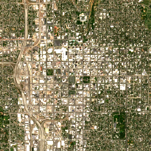
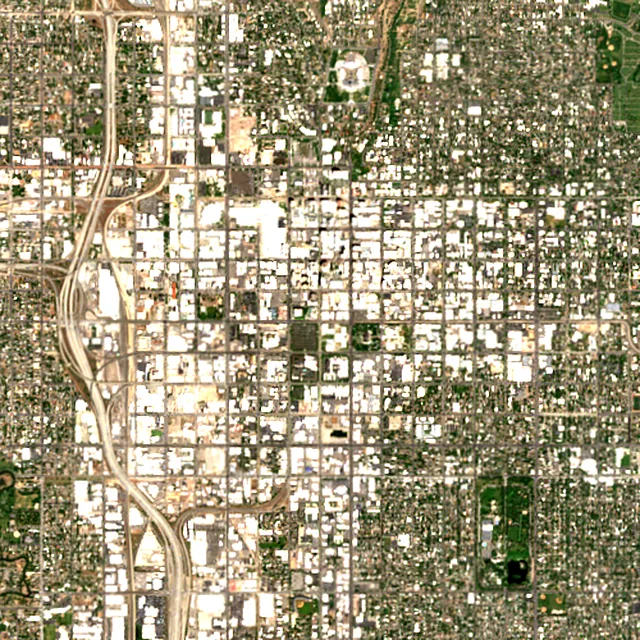

2017: satellite photo from June 2017 of a 5 × 5 km area in the city center.
- Forest lost since 2001
- 41 acres (17 ha)about 31 football fields
- Share of its forest
- under 1%of what there was in 2000
- Cleared for good
- 29 acres (12 ha)deforestation: turned into farms, mines or towns
The worst year was 2011, when about 11 acres (4 hectares) of forest were lost.
Acres of forest lost each year
Show the figures as a table
| Year | Cleared for good | Can grow back | Total |
|---|---|---|---|
| 2001 | under 1 ha | under 1 ha | under 1 ha |
| 2002 | under 1 ha | under 1 ha | under 1 ha |
| 2003 | 6 acres (2 ha) | under 1 ha | 6 acres (2 ha) |
| 2004 | under 1 ha | under 1 ha | under 1 ha |
| 2005 | under 1 ha | under 1 ha | under 1 ha |
| 2006 | under 1 ha | under 1 ha | under 1 ha |
| 2007 | under 1 ha | 2 acres (1 ha) | 3 acres (1 ha) |
| 2008 | under 1 ha | under 1 ha | under 1 ha |
| 2009 | under 1 ha | under 1 ha | under 1 ha |
| 2010 | under 1 ha | under 1 ha | under 1 ha |
| 2011 | 9 acres (4 ha) | under 1 ha | 11 acres (4 ha) |
| 2012 | under 1 ha | under 1 ha | under 1 ha |
| 2013 | under 1 ha | under 1 ha | under 1 ha |
| 2014 | under 1 ha | under 1 ha | under 1 ha |
| 2015 | under 1 ha | under 1 ha | under 1 ha |
| 2016 | under 1 ha | under 1 ha | under 1 ha |
| 2017 | under 1 ha | under 1 ha | under 1 ha |
| 2018 | under 1 ha | under 1 ha | under 1 ha |
| 2019 | under 1 ha | under 1 ha | under 1 ha |
| 2020 | under 1 ha | under 1 ha | under 1 ha |
| 2021 | under 1 ha | under 1 ha | under 1 ha |
| 2022 | 6 acres (3 ha) | under 1 ha | 7 acres (3 ha) |
| 2023 | under 1 ha | under 1 ha | under 1 ha |
| 2024 | under 1 ha | under 1 ha | under 1 ha |
| 2025 | under 1 ha | under 1 ha | under 1 ha |
What is causing deforestation around Salt Lake City?
- Towns and roadscleared for good58% · 24 acres (10 ha)
- Mining and energycleared for good7.9% · 3 acres (1 ha)
- Farms, pasture and plantationscleared for good3.6% · under 1 ha
Also: wildfires, unknown causes.
Causes for 2025 are estimates, based on what caused forest loss in the same places up to 2024.
Forest gained and lost, 2000–2020
- Forest in 2000
- 13,800 acres (5,600 ha)
- Forest in 2020
- 14,200 acres (5,760 ha)
- Overall change
- +403 acres (163 ha)more forest than in 2000
Comparing satellite maps from 2000 and 2020, the forest around Salt Lake City grew from about 13,800 acres (5,600 hectares) to 14,200 acres (5,760 hectares), a net gain of about 403 acres (163 hectares) (+2.9%). New forest grew on about 450 acres (182 hectares), while 48 acres (20 hectares) were lost.
These 2000 and 2020 maps, from the University of Maryland, count any land with trees taller than 5 m as forest, including plantations and orchards. Forest that was cut or burned and had grown back by 2020 counts in both years, so the loss here is smaller than the yearly figures.
These figures cover everything within 10 km of the city center, a wider area than the report above, because forest is usually lost at a city's edges.
Source: Hansen/UMD/Google/USGS/NASA, Global Forest Change (GFC-2025-v1.13); causes: WRI/Google DeepMind drivers of forest loss; both CC BY 4.0, summed by Airleaf for each area. Forest gained and lost 2000–2020: Potapov et al. 2022, UMD GLAD Global Land Cover and Land Use Change, CC BY 4.0. Images: contains modified Copernicus Sentinel data. How it's measured
In the same region
Measured cities near Salt Lake City
Same 2 km radius, same index — so they compare directly.
- West Valley City12.0 km
United States
- Tree cover
- 19%
- Air quality
- 39
- West Jordan17.3 km
United States
- Tree cover
- 18%
- Air quality
- 43
- Provo61.8 km
United States
- Tree cover
- 19%
- Air quality
- 22
- Boise476.2 km
United States
- Tree cover
- 37%
- Air quality
- 11
- Boulder566.7 km
United States
- Tree cover
- 38%
- Air quality
- 14
- Fort Collins574.2 km
United States
- Tree cover
- 38%
- Air quality
- 37
Build your own
Compare Salt Lake City with anywhere
This place
Salt Lake City
Use this data
Put Salt Lake City's numbers on your site
Free to embed. Updates itself as the measurement refreshes.
Frequently asked
Questions about Salt Lake City
What is the air quality (AQI) in Salt Lake City right now?
The latest reading for Salt Lake City shows an AQI of 35 (Good), measured Nov 11, 07:00 local time by 4 ground monitoring stations via OpenAQ (the median of their readings; the nearest is Hawthorne, 2.1 mi (3.4 km) away). The main pollutant is PM2.5. Air quality is satisfactory for everyone.
Is it safe to exercise outside in Salt Lake City today?
At AQI 35 (Good): a good day to be active outside. Windows: open them to air the house. Masks: not needed. The reading changes through the day, so check again before a long run or ride.
What has the air quality in Salt Lake City been like this week?
Over the last 7 days, the CAMS air-quality model put Salt Lake City's daily AQI at 67 on average, from 61 on Nov 5 to an hourly peak of 88 on Nov 8. No day averaged above 100, the level where the air turns unhealthy for sensitive groups.
Why is Salt Lake City's air so bad in winter?
Winter inversions: a layer of warm air traps cold air, and its pollution, in the valley, typically from November through February. The surrounding mountains hold it in place until the weather changes and clears it.
When is the air worst in Salt Lake City?
During winter inversions, typically November through February, when fine particles (PM2.5) build up day after day. In summer the problem is ozone, on hot and sunny afternoons.
Can I burn wood in Salt Lake City in winter?
Not on action days. From November, Utah declares voluntary and mandatory action days; on mandatory days, wood- and coal-burning stoves and fireplaces may not be used. Check the day's status before lighting a fire.
How much forest has the area around Salt Lake City lost since 2001?
Since 2001, the area within 10 km of Salt Lake City has lost about 41 acres (17 hectares) of forest (about 31 football fields): under 1% of the forest it had in 2000. Most of it (70%) was deforestation, forest cleared for good, mainly for towns and roads. Comparing satellite maps from 2000 and 2020, the forest around Salt Lake City grew from about 13,800 acres (5,600 hectares) to 14,200 acres (5,760 hectares), a net gain of about 403 acres (163 hectares) (+2.9%). New forest grew on about 450 acres (182 hectares), while 48 acres (20 hectares) were lost.
What is the tree count in Salt Lake City?
Salt Lake City has an estimated 44,611 trees across the 4.9 sq mi (12.57 km²) measured — 14.2% tree cover, 16 percentage points short of the 30% tree-cover target set for this area.
How many more trees does Salt Lake City need?
Salt Lake City needs roughly 49,637 more trees to close a 16-point shortfall against its 30% tree-cover target — about 1,092 t of extra CO₂ absorbed per year once grown.
How are Salt Lake City's air quality and tree cover measured?
Air quality is measured by ground monitoring stations near Rio Grande, via OpenAQ; the 7-day trend is the Open-Meteo / CAMS model's estimate. Tree cover is measured from Sentinel-2 L2A (ESA Copernicus) via Earth Search satellite imagery at 10 m detail across a 1.2 mi (2 km) radius around Rio Grande; the tree count is an estimate derived from that cover.
See your own area
What does your neighborhood look like?
Pick any point and radius to get the same air-quality and tree-cover breakdown.
Check my address